LiDAR Benchmarking & Habitat Modelling
Using airborne LiDAR to detect Malleefowl mounds across vast landscapes and model the vegetation structure that defines prime breeding habitat, especially in the Murchison and Coolgardie bioregions of WA.
Project at a glance
Project Aim
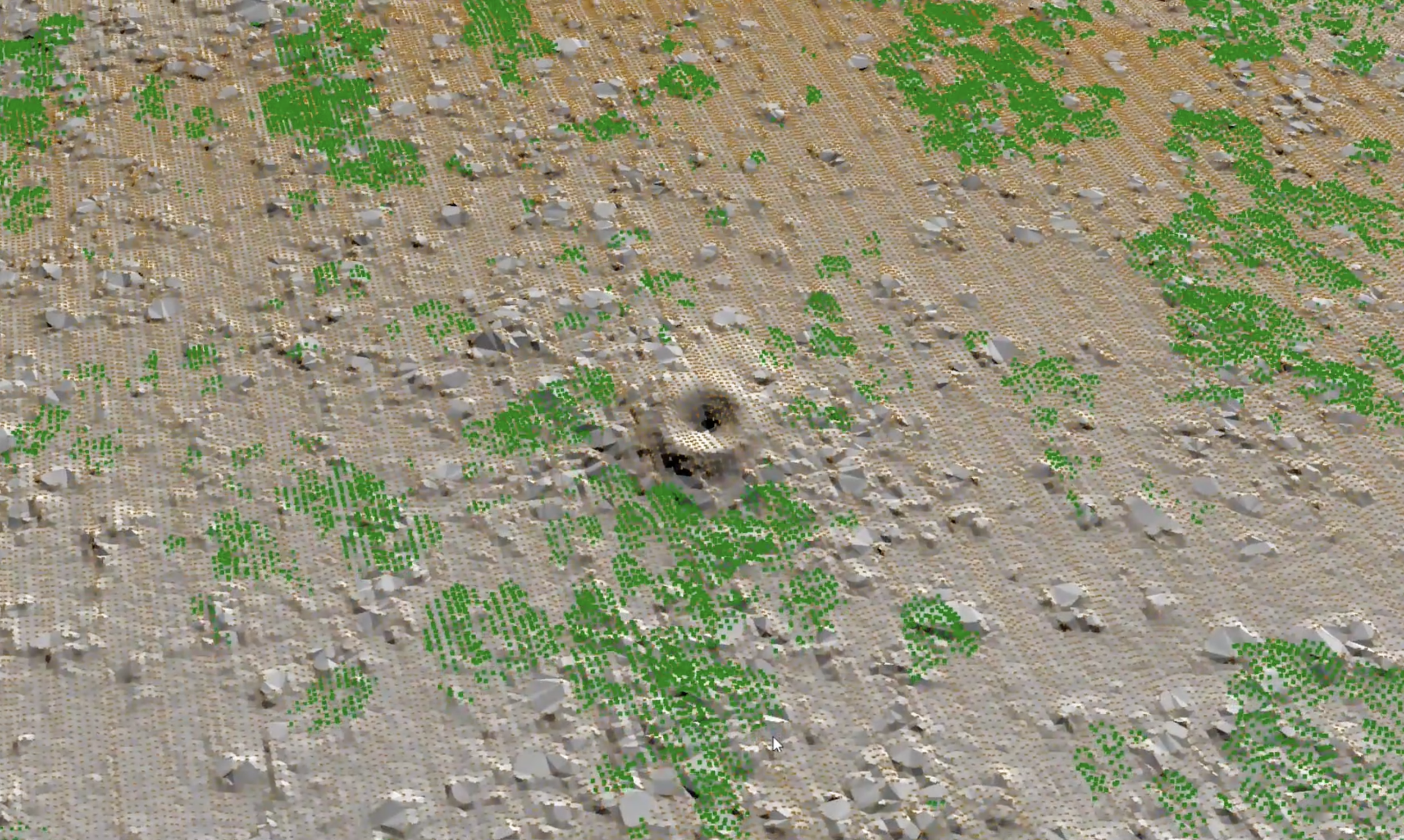
Use established LiDAR techniques to determine where Malleefowl mounds occur, particularly in the Murchison and Coolgardie bioregions, vast areas where Malleefowl occur at low density and ground surveys are impractical. The LiDAR data will be ground-truthed and used to refine population estimates, and vegetation structural data from LiDAR will be used to describe the species' habitat requirements to enable conservation planning.
Background
Malleefowl have declined enormously over the past century, primarily due to clearing for agriculture, especially cereal production. It is estimated that only around 25,000 breeding Malleefowl may now survive. A national monitoring program has shown that breeding numbers have continued to decline over the last 30 years even within remaining habitat in WA.
There is an urgent need to assess the size and distribution of remaining populations to better understand where and how to recover the species, particularly given the additional pressure of a changing climate. Current knowledge of where Malleefowl actually occur across the Murchison and Coolgardie bioregions is severely limited. LiDAR offers a scalable solution.
How This Benefits Malleefowl
Developing a better understanding of the distribution, size, and trends in Malleefowl populations is essential information for conservation, as per the National Recovery Plan for Malleefowl (Objectives 8, 9, 10). This project will provide information used to describe the species' habitat requirements (Objective 12) and facilitate conservation planning.
The results will also be used as a basis for developing new monitoring sites to track population trends, and the information obtained will be used to advise offset considerations and management of Malleefowl throughout Australia.